Mount Ararat


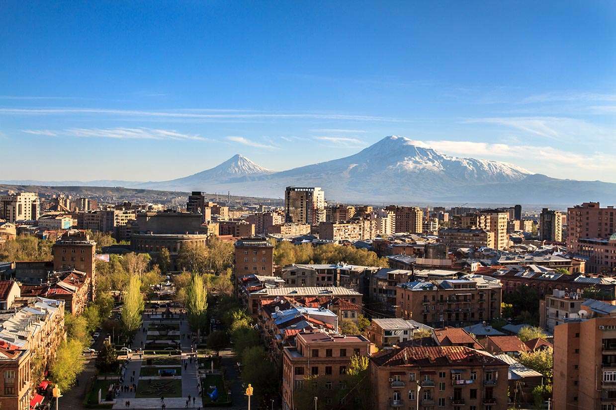
Mount Ararat or Masis in Armenian, also called Great Ararat is a dormant volcano in the Arara homeland in eastern Anatolia near the border with Armenia, Iran, and the Azerbaijani Nakhichevan exclave. At 5165 meters above sea level, it is the highest mountain of the Armenian Highlands although it is located on today's territory of Turkey. Ararat has a small neighbouring mountain, named small Ararat or Sis and is 3925 meters high. In 2004 both mountains were included in the national park. Mount Ararat is considered the final resting place of Biblical Noah’s Ark. It is therefore referred to as the biblical mountain. However, acknowledged scientific evidence for this report is missing. Some authors claim that the biblical story does not refer directly to Mount Ararat, but in general to the realm of Urartu, which was inscribed in an Assyrian cuneiform script. A geological formation near the summit known as the "Ararat Anomaly" was revealed in the 20th century through aerial photography, which nourished speculation about the remains of the biblical Noah's Ark.
Although Ararat is located in Turkey, it is now considered a national symbol of Armenia. It is depicted in the state coat of arms of the Republic of Armenia. In the 19th century, when the Armenian state did not exist, Ararat symbolized the Armenian statehood. The first Republic of Armenia, the first modern Armenian state structure, existed between 1918 and 1921, often called the Ararat Republic or the Republic of Ararat, as it was located in the Ararat Valley. Turkey protested by pointing out that the mountain was located on Turkish territory and therefore, cannot be seized by Armenia or the Soviet Union. Soviet Foreign Minister Gromyko later countered and asked the Turks why they had depicted crescent on their flag. Did they lay claim to the Moon? On the state emblem of Armenia, the four Armenian royal houses: Artashesian, Arshakuni, Bagratuni, and Rubinian, are represented in the middle of Mount Ararat with Noah's Ark. Geographically, Ararat is in the center of the four ancient kingdoms of Armenia, for this reason, the mountain is part of the historical home of the Armenians.
The first historically proven summit ascent of the Great Ararat took place in 1829 by a small expedition group. This expedition was headed by the rector of the University of Dorpat (Estonia) Friedrich Parrot. He was accompanied by his Armenian leader Khachatur Abovyan, who is considered the founder of new Armenian literature. They also accompanied the two Russian soldiers Alexey Sdrovenko and Matvey Chalpanov from the 41st Russian Hunters Regiment, as well as the two farmers Hovhannes Ayvassian and Murat Pogossian from the nearby village of Arguri. The next expedition was led by James Bryce, who climbed Mount Ararat in 1876. He claimed that he uncovered a piece of processed wood at an altitude of 4,000 meters. The most favorable season for expeditions is summer. Most of the mountain is ascended from the south side. There are other routes from east and north, that lead to the summit. "It is considered that Ararat can be easily climbed in June, July, and August, but in winter it is extremely difficult and can be very dangerous. We also have a rescue team. We have already brought down a few dead bodies."(Statement by the Kurdish mountain guide Kemal Çeven, who claims to have climbed the Ararat 200 times). "In the winter months, the climate on the mountain is very unfavorable, as the snowstorms often make climbing impossible".
The peak of Ararat is covered with eternal ice, which began to melt around 1957. In the late 1950s, Blumenthal observed that there existed 11 glaciers emerging from a snow mass that covered about 10 km².